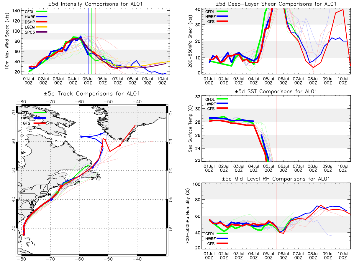
Forecast Track
Time of Latest Forecast: 2014-07-05 12:00
| Forecast Hour | Latitude | Longitude | Intensity |
| 0 | 44.5 | 293.7 | 55 |
| 12 | 47.0 | 296.5 | 45 |
| 24 | 49.0 | 300.0 | 40 |
| 36 | 52.0 | 304.0 | 35 |
| 48 | 56.0 | 307.0 | 35 |
| 72 | 60.5 | 306.0 | 30 |
| 96 | 60.5 | 307.5 | 20 |
| 120 | 0.0 | 0.0 | 0 |
Track History
| Synoptic Time | Latitude | Longitude | Intensity |
| 2014-07-05 12:00 | 44.5 | -66.3 | 55 |
| 2014-07-05 06:00 | 42.3 | -67.6 | 60 |
| 2014-07-05 00:00 | 40.3 | -69.6 | 65 |
| 2014-07-04 18:00 | 38.4 | -72.4 | 75 |
| 2014-07-04 12:00 | 36.8 | -74.4 | 85 |
| 2014-07-04 06:00 | 35.4 | -76.0 | 85 |
| 2014-07-04 00:00 | 34.0 | -77.3 | 85 |
| 2014-07-03 18:00 | 32.9 | -78.3 | 80 |
| 2014-07-03 12:00 | 31.8 | -78.7 | 75 |
| 2014-07-03 06:00 | 30.8 | -79.2 | 60 |
| 2014-07-03 00:00 | 30.2 | -79.2 | 60 |
| 2014-07-02 18:00 | 29.4 | -79.1 | 55 |
| 2014-07-02 12:00 | 28.8 | -79.0 | 50 |
| 2014-07-02 06:00 | 28.1 | -79.2 | 50 |
| 2014-07-02 00:00 | 27.7 | -79.2 | 45 |
| 2014-07-01 18:00 | 27.7 | -79.3 | 40 |
| 2014-07-01 12:00 | 27.5 | -79.2 | 30 |
| 2014-07-01 06:00 | 27.6 | -79.2 | 30 |
| 2014-07-01 00:00 | 27.6 | -79.0 | 30 |
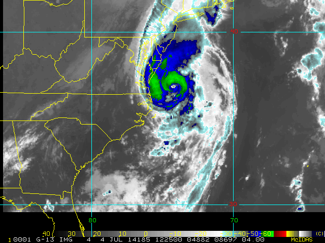
Enhanced Infrared (IR) Imagery (4 km Mercator)

Loop | Latest Image | Archive | About
Time of This Image: 2014-07-04 12:25
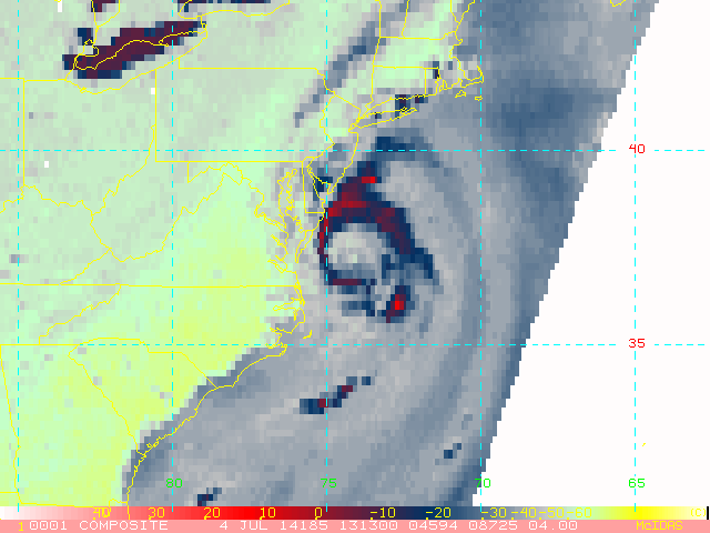
AMSU Microwave 89 GHz Imagery (4 km Mercator)

Loop | Latest Image | Archive | About
Time of This Image: 2014-07-04 13:13
Multiplatform Satellite Surface Wind Analysis (Experimental)
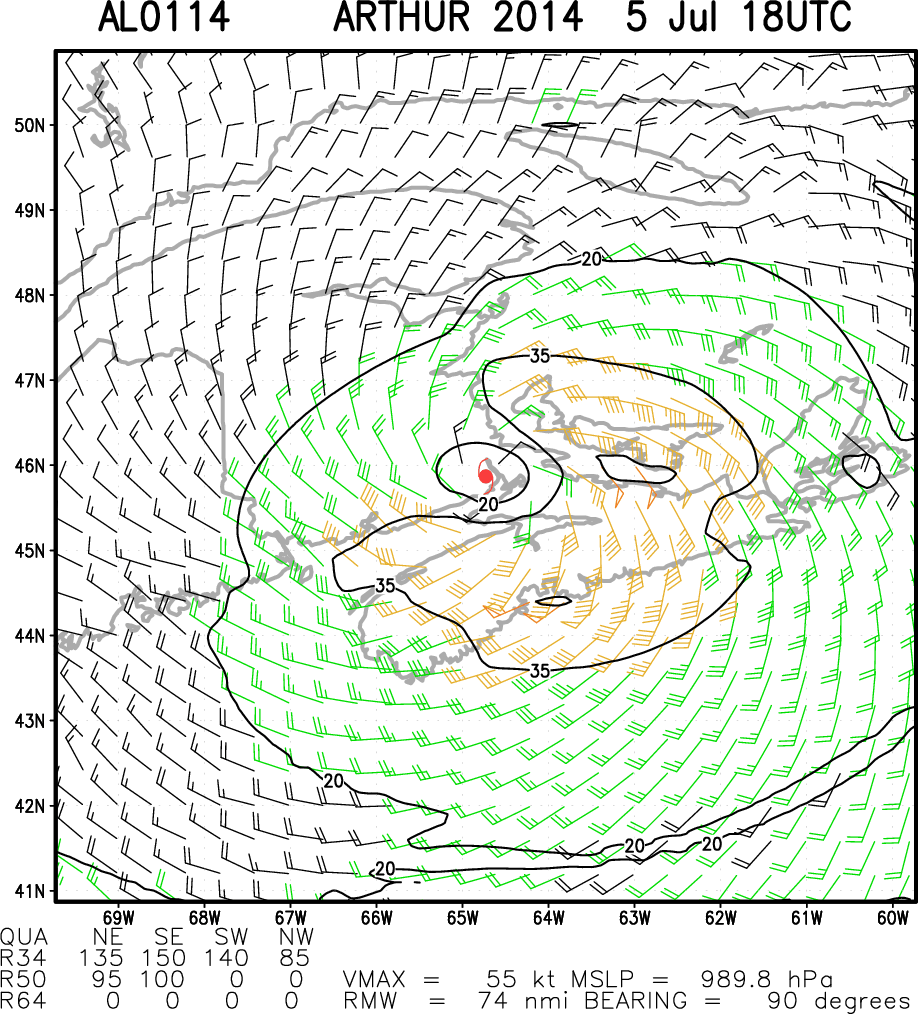
Latest Image | Archive | About
Time of This Image: 2014-07-05 18:00
Ocean Heat Content & Forecast Track
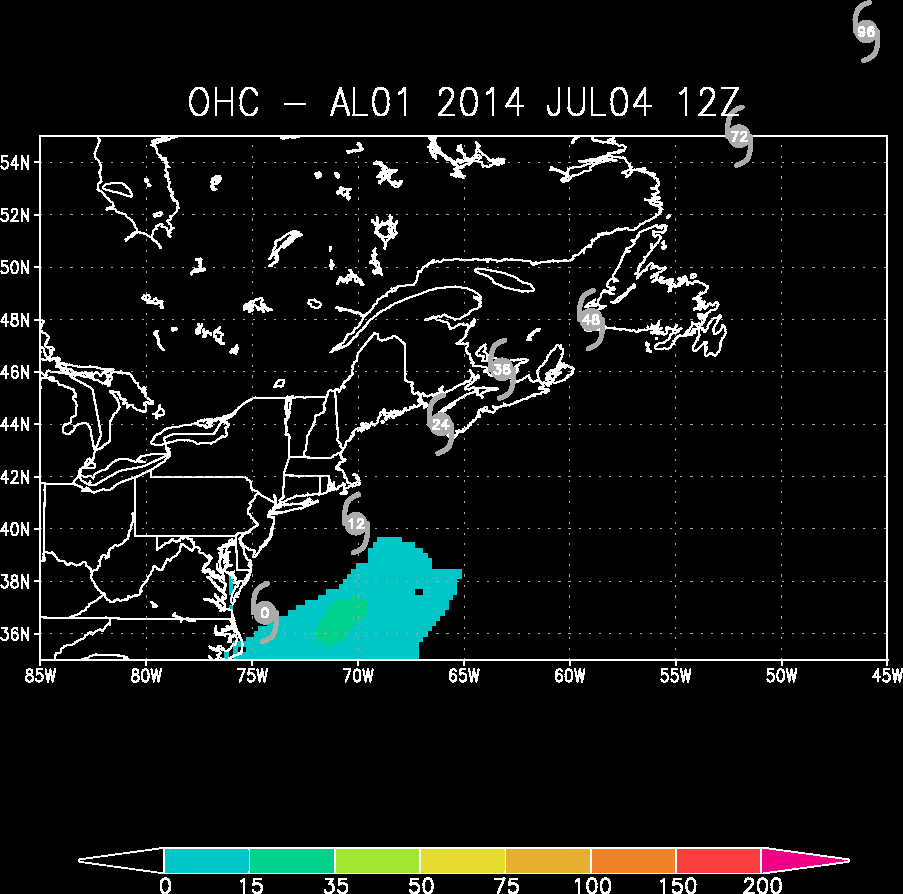
Latest Image | Archive | About
Time of This Image: 2014-07-04 12:00
