Forecast Track
Time of Latest Forecast: 2018-07-12 12:00
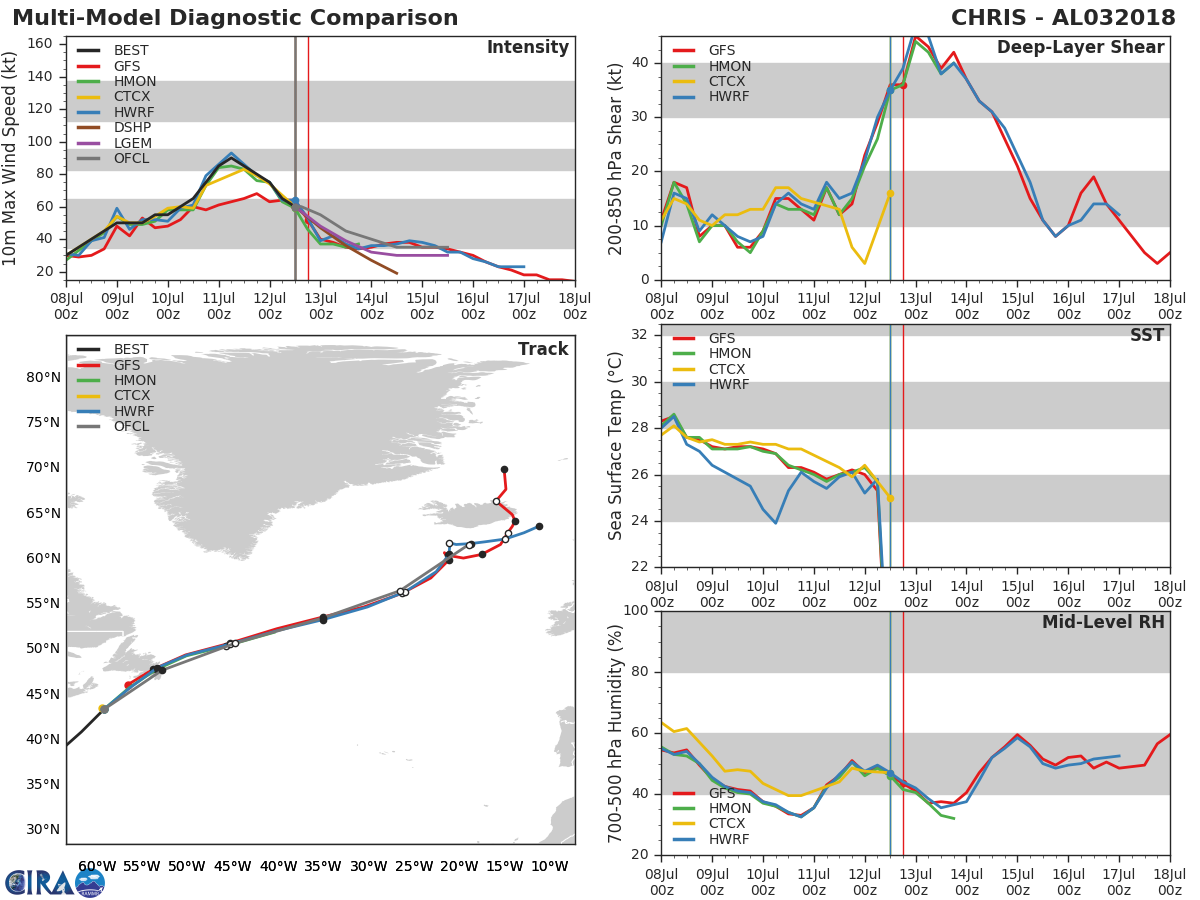
| Forecast Hour | Latitude | Longitude | Intensity |
| 0 | 43.4 | 300.8 | 60 |
| 12 | 47.7 | 307.2 | 55 |
| 24 | 50.7 | 315.3 | 45 |
| 36 | 53.5 | 325.0 | 40 |
| 48 | 56.5 | 333.5 | 35 |
| 72 | 61.6 | 341.1 | 35 |
| 96 | 0.0 | 0.0 | 0 |
| 120 | 0.0 | 0.0 | 0 |
Track History
| Synoptic Time | Latitude | Longitude | Intensity |
| 2018-07-12 12:00 | 43.4 | -59.2 | 60 |
| 2018-07-12 06:00 | 41.0 | -61.5 | 65 |
| 2018-07-12 00:00 | 38.5 | -64.4 | 75 |
| 2018-07-11 18:00 | 37.0 | -66.8 | 80 |
| 2018-07-11 12:00 | 35.7 | -69.0 | 85 |
| 2018-07-11 06:00 | 34.7 | -70.7 | 90 |
| 2018-07-11 00:00 | 33.9 | -71.9 | 85 |
| 2018-07-10 18:00 | 33.4 | -72.8 | 75 |
| 2018-07-10 12:00 | 32.8 | -73.5 | 60 |
| 2018-07-10 06:00 | 32.4 | -74.2 | 60 |
| 2018-07-10 00:00 | 32.3 | -74.3 | 60 |
| 2018-07-09 18:00 | 32.2 | -74.4 | 55 |
| 2018-07-09 12:00 | 32.2 | -74.5 | 50 |
| 2018-07-09 06:00 | 32.5 | -74.5 | 50 |
| 2018-07-09 00:00 | 32.6 | -74.5 | 55 |
| 2018-07-08 18:00 | 32.7 | -74.9 | 45 |
| 2018-07-08 12:00 | 33.3 | -75.0 | 40 |
| 2018-07-08 06:00 | 33.2 | -75.5 | 35 |
| 2018-07-08 00:00 | 32.8 | -75.1 | 30 |
| 2018-07-07 18:00 | 32.9 | -75.3 | 30 |
| 2018-07-07 12:00 | 33.0 | -74.8 | 25 |
| 2018-07-07 06:00 | 33.0 | -74.5 | 25 |
| 2018-07-07 00:00 | 32.4 | -74.0 | 25 |
| 2018-07-06 18:00 | 32.0 | -73.7 | 25 |
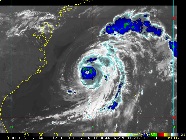
Enhanced Infrared (IR) Imagery (4 km Mercator)

Loop | Latest Image | Archive | About
Time of This Image: 2018-07-11 06:00
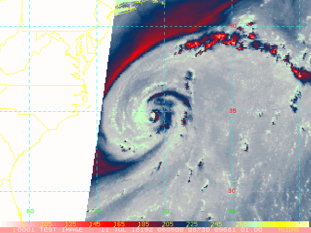
AMSU Microwave 89 GHz Imagery (4 km Mercator)

Loop | Latest Image | Archive | About
Time of This Image: 2018-07-11 06:05
Multiplatform Satellite Surface Wind Analysis (Experimental)
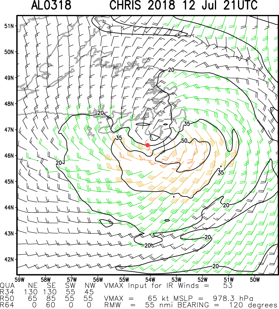
Latest Image | Archive | About
Time of This Image: 2018-07-12 21:00
Ocean Heat Content & Forecast Track
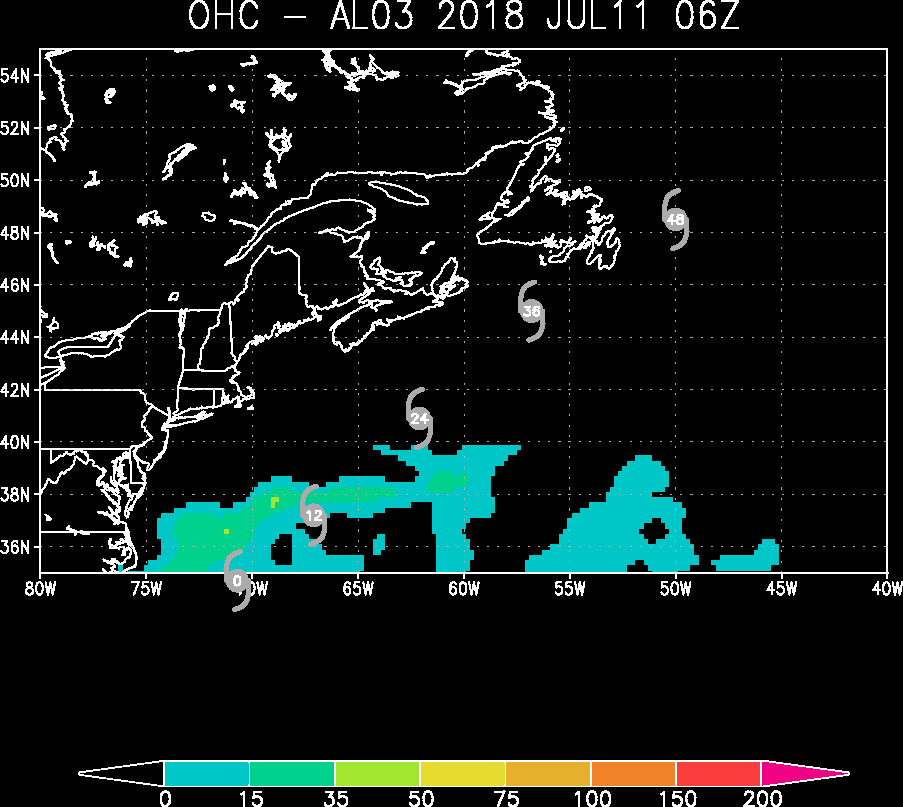
Latest Image | Archive | About
Time of This Image: 2018-07-11 06:00
