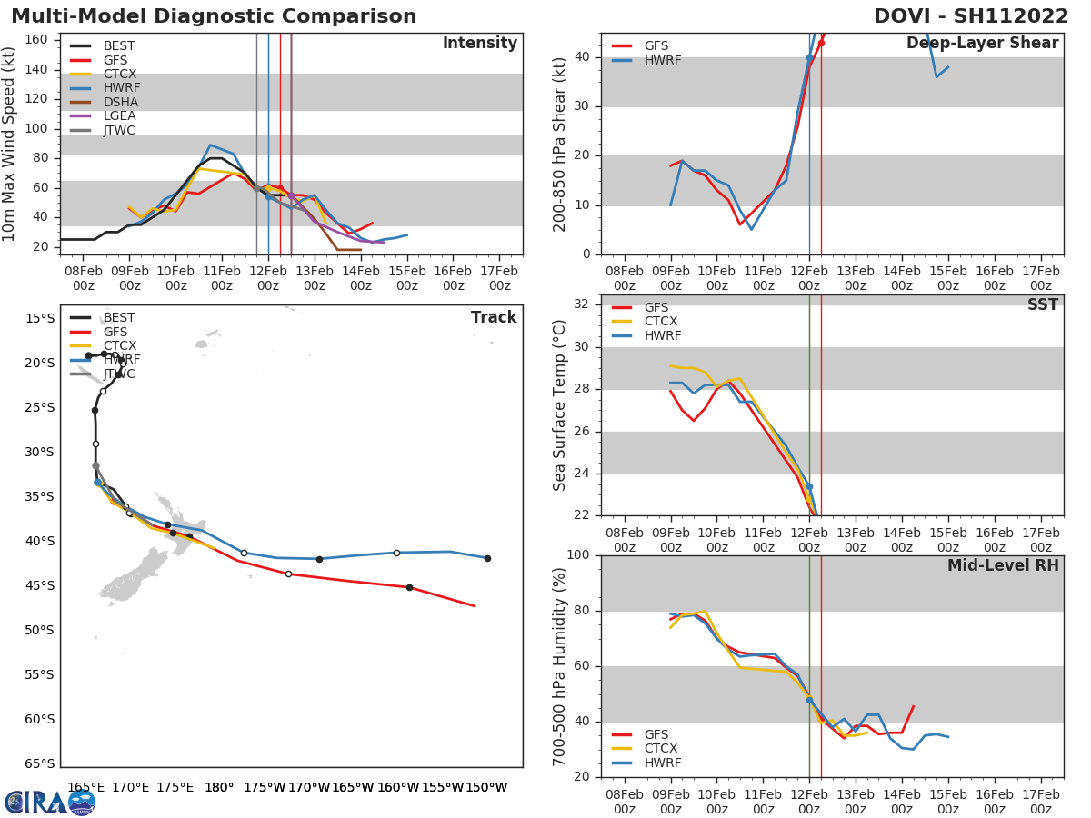
Forecast Track
Time of Latest Forecast: 2022-02-11 18:00
| Forecast Hour | Latitude | Longitude | Intensity |
| 0 | -31.4 | 166.1 | 60 |
| 12 | -35.4 | 168.3 | 50 |
| 24 | -38.1 | 172.4 | 45 |
| 36 | 0.0 | 0.0 | 0 |
| 48 | 0.0 | 0.0 | 0 |
| 72 | 0.0 | 0.0 | 0 |
| 96 | 0.0 | 0.0 | 0 |
| 120 | 0.0 | 0.0 | 0 |
Track History
| Synoptic Time | Latitude | Longitude | Intensity |
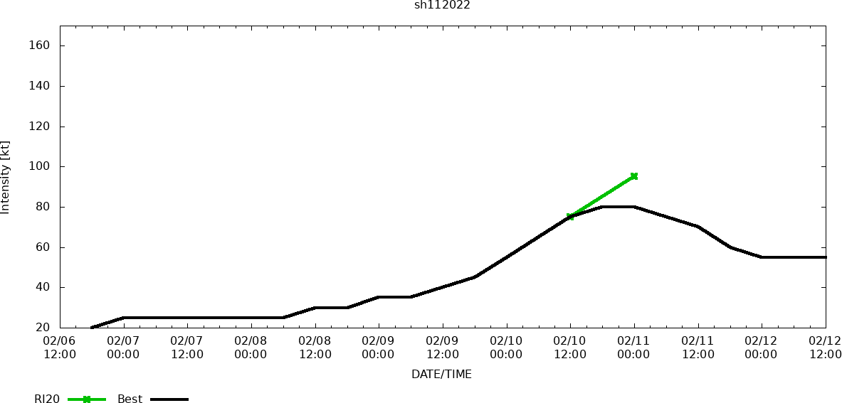
| 2022-02-12 12:00 | -36.8 | 170.1 | 55 |
| 2022-02-12 06:00 | -34.1 | 168.1 | 45 |
| 2022-02-12 00:00 | -33.3 | 166.3 | 55 |
| 2022-02-11 18:00 | -31.4 | 165.8 | 60 |
| 2022-02-11 12:00 | -28.9 | 166.0 | 70 |
| 2022-02-11 06:00 | -26.8 | 166.2 | 80 |
| 2022-02-10 12:00 | -23.0 | 166.9 | 75 |
| 2022-02-10 06:00 | -22.2 | 167.9 | 60 |
| 2022-02-10 00:00 | -21.2 | 168.6 | 55 |
| 2022-02-09 18:00 | -20.3 | 168.9 | 45 |
| 2022-02-09 12:00 | -20.2 | 169.6 | 40 |
| 2022-02-09 06:00 | -20.0 | 169.0 | 35 |
| 2022-02-09 00:00 | -19.6 | 168.9 | 35 |
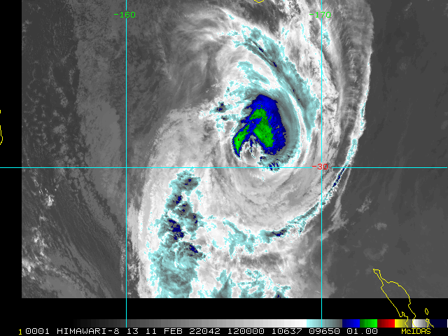
Enhanced Infrared (IR) Imagery (4 km Mercator)

Loop | Latest Image | Archive | About
Time of This Image: 2022-02-11 12:00
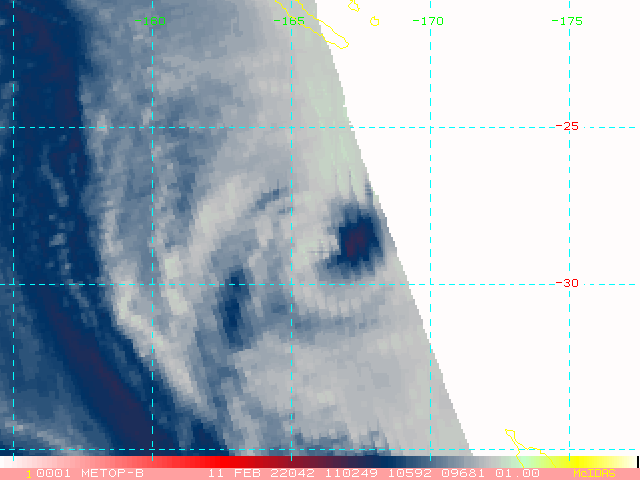
AMSU Microwave 89 GHz Imagery (4 km Mercator)

Loop | Latest Image | Archive | About
Time of This Image: 2022-02-11 11:02
Multiplatform Satellite Surface Wind Analysis (Experimental)
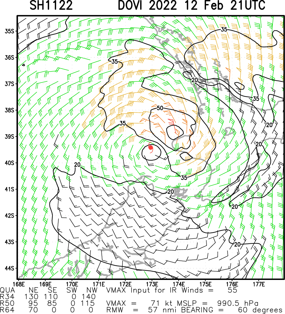
Latest Image | Archive | About
Time of This Image: 2022-02-12 21:00
Ocean Heat Content & Forecast Track
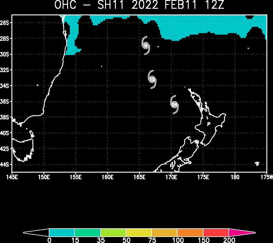
Latest Image | Archive | About
Time of This Image: 2022-02-11 12:00

RIPA Storm Table
Please use the links below to view the text data for this product.
Latest Text File | | Archive | About
Time of This Image: 2022-02-12 12:00