Forecast Track
Time of Latest Forecast: 2013-10-03 00:00
| Forecast Hour | Latitude | Longitude | Intensity |
| 0 | 0.0 | 0.0 | 0 |
| 12 | 0.0 | 0.0 | 0 |
| 24 | 0.0 | 0.0 | 0 |
| 36 | 0.0 | 0.0 | 0 |
| 48 | 0.0 | 0.0 | 0 |
| 72 | 0.0 | 0.0 | 0 |
| 96 | 0.0 | 0.0 | 0 |
| 120 | 0.0 | 0.0 | 0 |
Track History
| Synoptic Time | Latitude | Longitude | Intensity |
| 2013-10-03 00:00 | 44.0 | 149.4 | 35 |
| 2013-10-02 18:00 | 40.4 | 145.9 | 35 |
| 2013-10-02 12:00 | 37.2 | 143.3 | 35 |
| 2013-10-02 06:00 | 35.5 | 142.0 | 35 |
| 2013-10-02 00:00 | 33.9 | 141.7 | 35 |
| 2013-10-01 18:00 | 32.6 | 141.2 | 35 |
| 2013-10-01 12:00 | 31.2 | 141.6 | 35 |
| 2013-10-01 06:00 | 30.2 | 141.5 | 35 |
| 2013-10-01 00:00 | 29.0 | 141.7 | 30 |
| 2013-09-30 18:00 | 28.5 | 142.2 | 30 |
| 2013-09-30 12:00 | 28.0 | 143.8 | 30 |
| 2013-09-30 06:00 | 27.2 | 145.2 | 30 |
| 2013-09-30 00:00 | 26.6 | 146.7 | 30 |
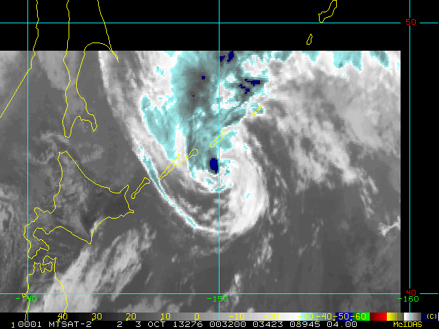
Enhanced Infrared (IR) Imagery (4 km Mercator)

Loop | Latest Image | Archive | About
Time of This Image: 2013-10-03 00:32
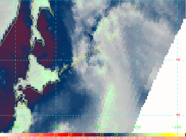
AMSU Microwave 89 GHz Imagery (4 km Mercator)

Loop | Latest Image | Archive | About
Time of This Image: 2013-10-03 00:17
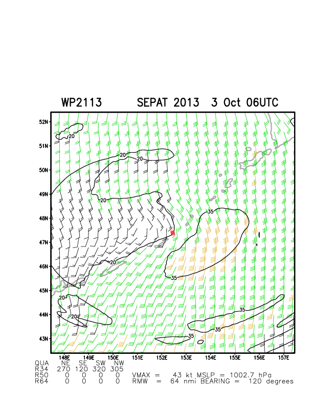
Multiplatform Satellite Surface Wind Analysis (Experimental)
Latest Image | Archive | About
Time of This Image: 2013-10-03 06:00