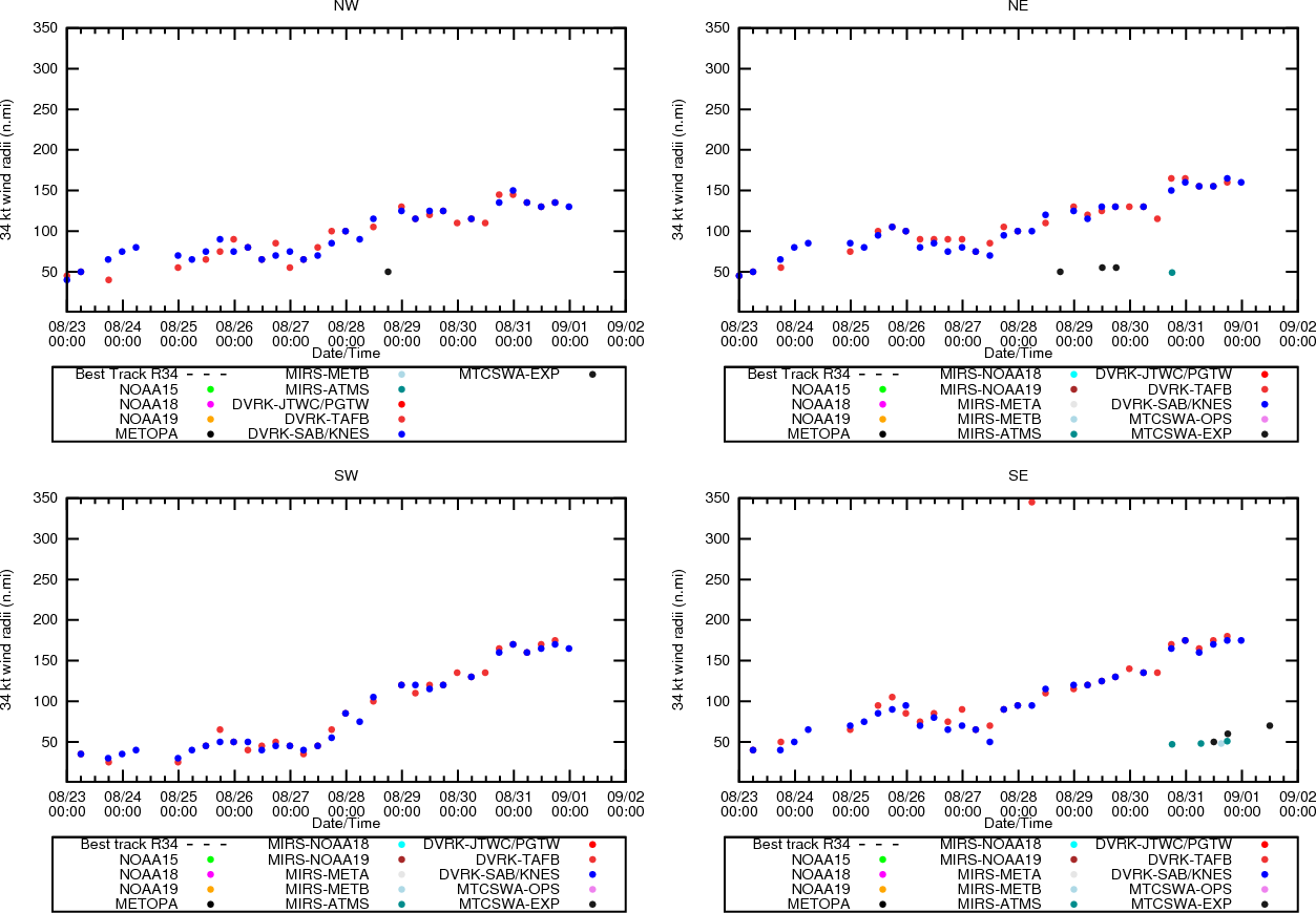
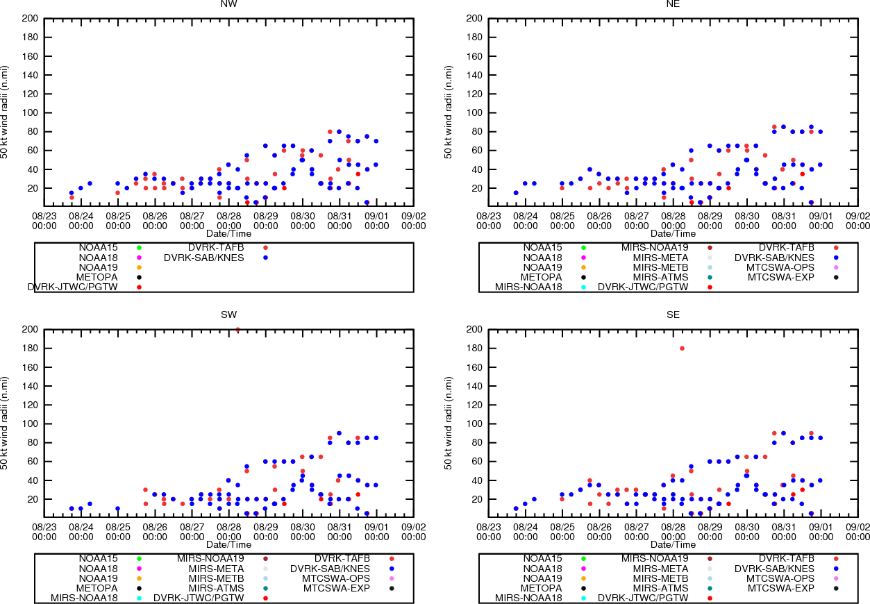
Aircraft-based Tropical Cyclone Surface Wind Analysis

Latest Image | Archive | About
Time of This Image: 2016-08-30 06:00
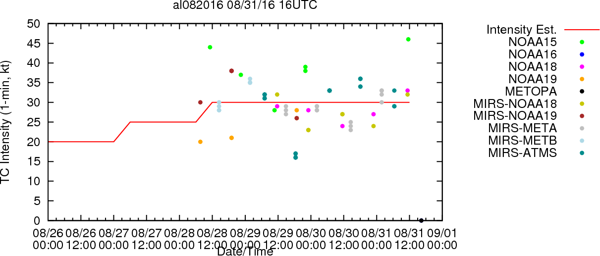
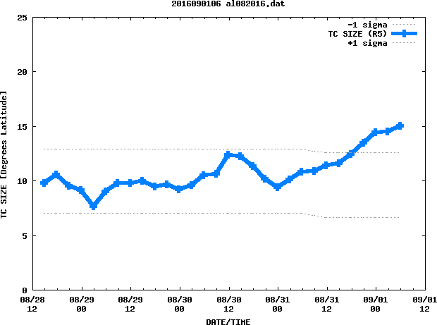
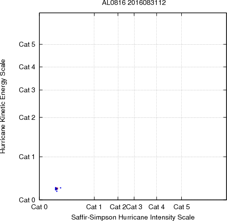
Multiplatform Tropical Cyclone Kinetic Energy and Intensity

Loop | Latest Image | Archive | About
Time of This Image: 2016-08-31 12:00
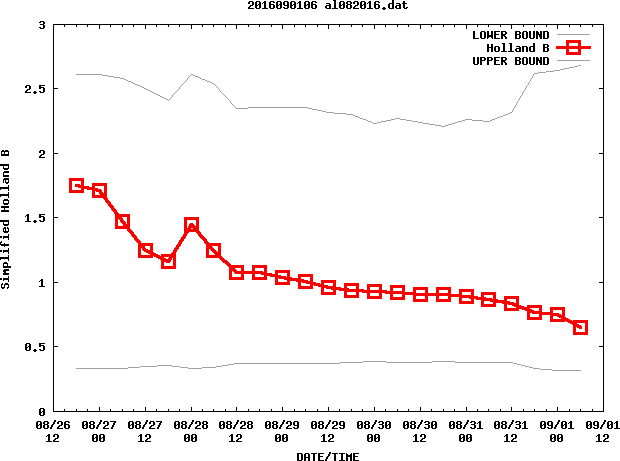
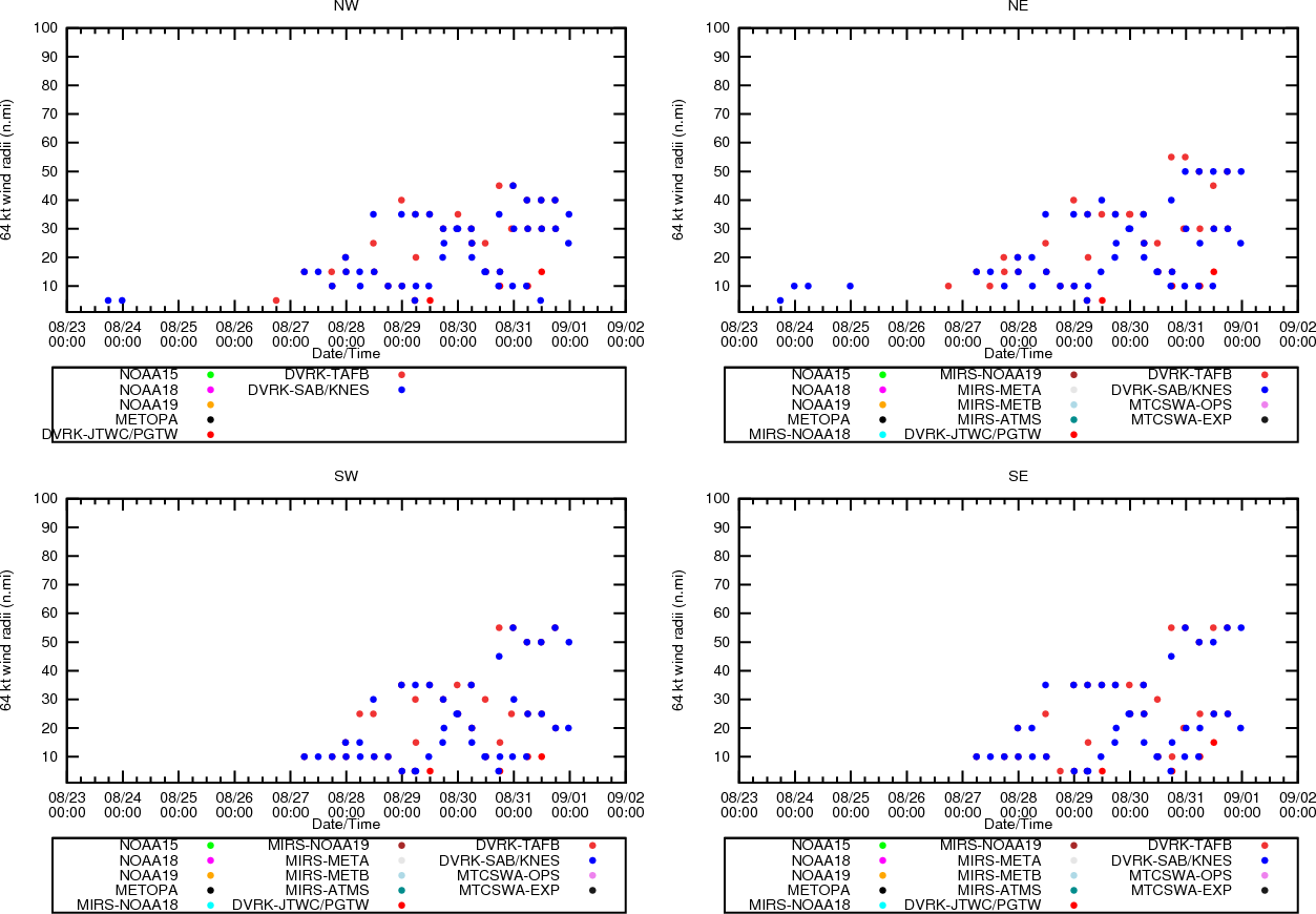
Multiplatform Tropical Cyclone MSLP and Maximum Winds
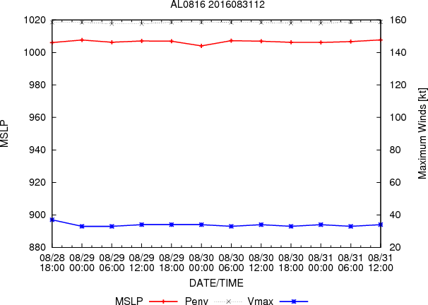
Latest Image | Archive | About
Time of This Image: 2016-08-31 12:00

Collocation of AMSU and Dropsonde Soundings
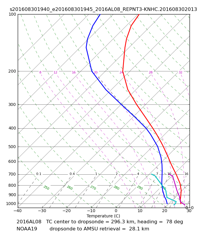
Loop | Latest Image | Archive | About
Time of This Image: 2016-08-30 19:41
Collocation of ATMS and Dropsonde Soundings
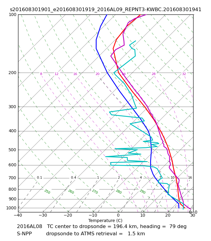
Loop | Latest Image | Archive | About
Time of This Image: 2016-08-30 19:01
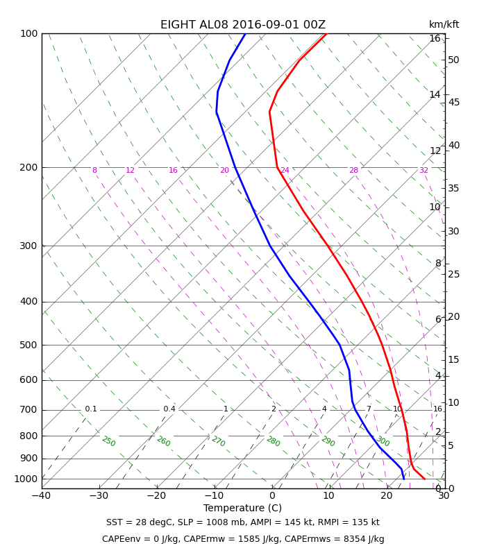
ATMS Maximum Potential Intensity

Loop | Latest Image | Archive | About
Time of This Image: 2016-09-01 00:00

Multiplatform Satellite Surface Wind Analysis (Experimental)

Latest Image | Archive | About
Time of This Image: 2016-09-01 12:00
Ocean Heat Content & Forecast Track
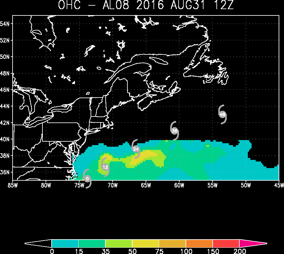
Latest Image | Archive | About
Time of This Image: 2016-08-31 12:00
AMSU Radial/Height Cross Sections

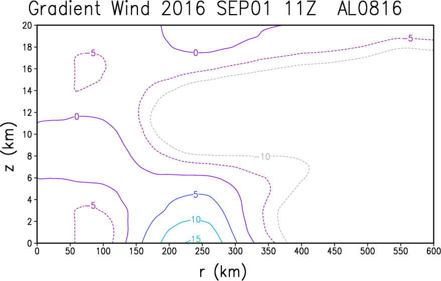
Latest Image | Archive | About
Time of This Image: 2016-09-01 11:08