Aircraft-based Tropical Cyclone Surface Wind Analysis

Latest Image | Archive | About
Time of This Image: 2016-09-06 00:00
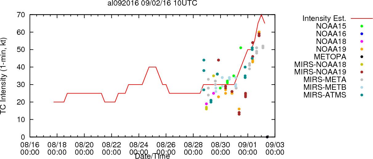
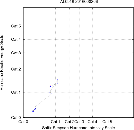
Multiplatform Tropical Cyclone Kinetic Energy and Intensity

Loop | Latest Image | Archive | About
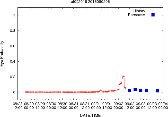
Time of This Image: 2016-09-02 06:00
Multiplatform Tropical Cyclone MSLP and Maximum Winds
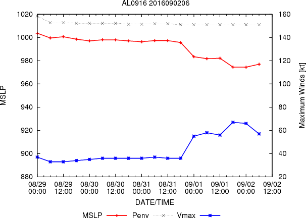
Latest Image | Archive | About
Time of This Image: 2016-09-02 06:00

Collocation of AMSU and Dropsonde Soundings
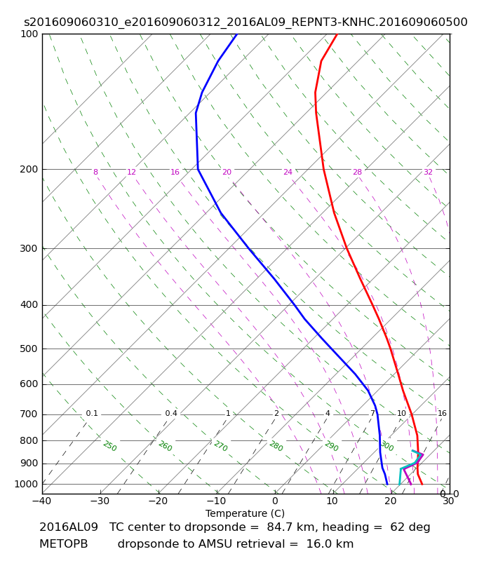
Loop | Latest Image | Archive | About
Time of This Image: 2016-09-06 03:13
Collocation of ATMS and Dropsonde Soundings
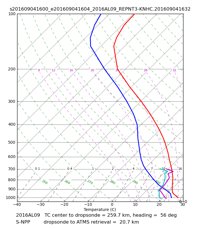
Loop | Latest Image | Archive | About
Time of This Image: 2016-09-04 16:00
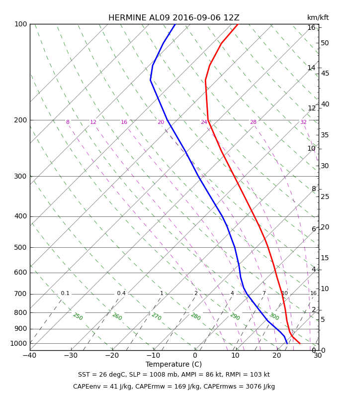
ATMS Maximum Potential Intensity

Loop | Latest Image | Archive | About
Time of This Image: 2016-09-06 12:00

Dvorak Fix-Based Wind Radii (Text; ATCF ANAL fixes)
Please use the links below to view the text data for this product.

Multiplatform Satellite Surface Wind Analysis (Experimental)

Latest Image | Archive | About
Time of This Image: 2016-09-06 18:00
Ocean Heat Content & Forecast Track
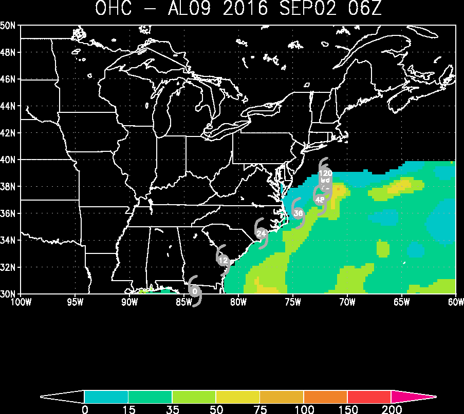
Latest Image | Archive | About
Time of This Image: 2016-09-02 06:00
AMSU Radial/Height Cross Sections


Latest Image | Archive | About
Time of This Image: 2016-09-06 11:48