Geostationary Imagery
Enhanced Infrared (IR) Imagery (4 km Mercator)

Loop | Latest Image | Archive | About
Time of This Image: 2025-07-30 18:00
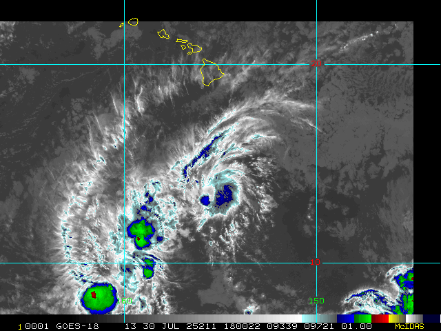
Storm Relative 1 km Geostationary Visible Imagery

Loop | Latest Image | Archive | About
Time of This Image: 2025-07-30 18:00
2 km Storm Relative IR Imagery with BD Enhancement Curve

Loop | Latest Image | Archive | About
Time of This Image: 2025-07-30 18:00
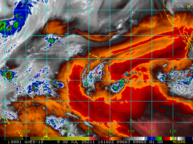
Storm Relative 16 km Geostationary Water Vapor Imagery

Loop | Latest Image | Archive | About
Time of This Image: 2025-07-30 18:10
Low-Earth Imagery
85 – 92 GHz Brightness Temperature

Loop | Latest Image | Archive | About
Time of This Image: 2025-07-30 19:32
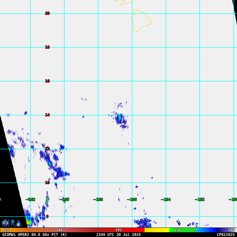
85 – 92 GHz Polarization-Corrected Brightness Temperature

Loop | Latest Image | Archive | About
Time of This Image: 2025-07-30 23:49
37 GHz Passive Microwave Imagery

Loop | Latest Image | Archive | About
Time of This Image: 2025-07-30 23:49
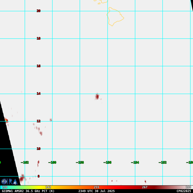
37 GHz Polarization-Corrected Brightness Temperature

Loop | Latest Image | Archive | About
Time of This Image: 2025-07-30 23:49
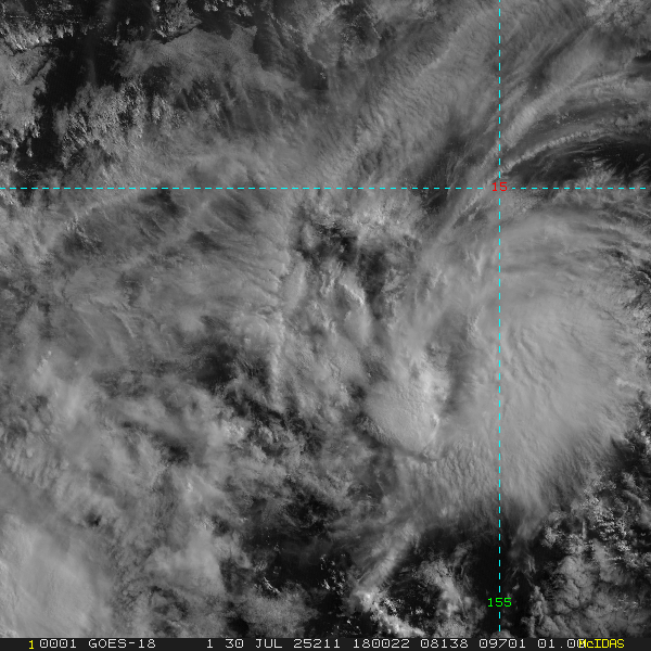
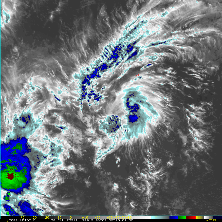
Enhanced Infrared (IR) Imagery (1 km Mercator, MODIS/AVHRR)

Loop | Latest Image | Archive | About
Time of This Image: 2025-07-30 19:09
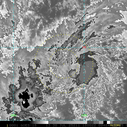
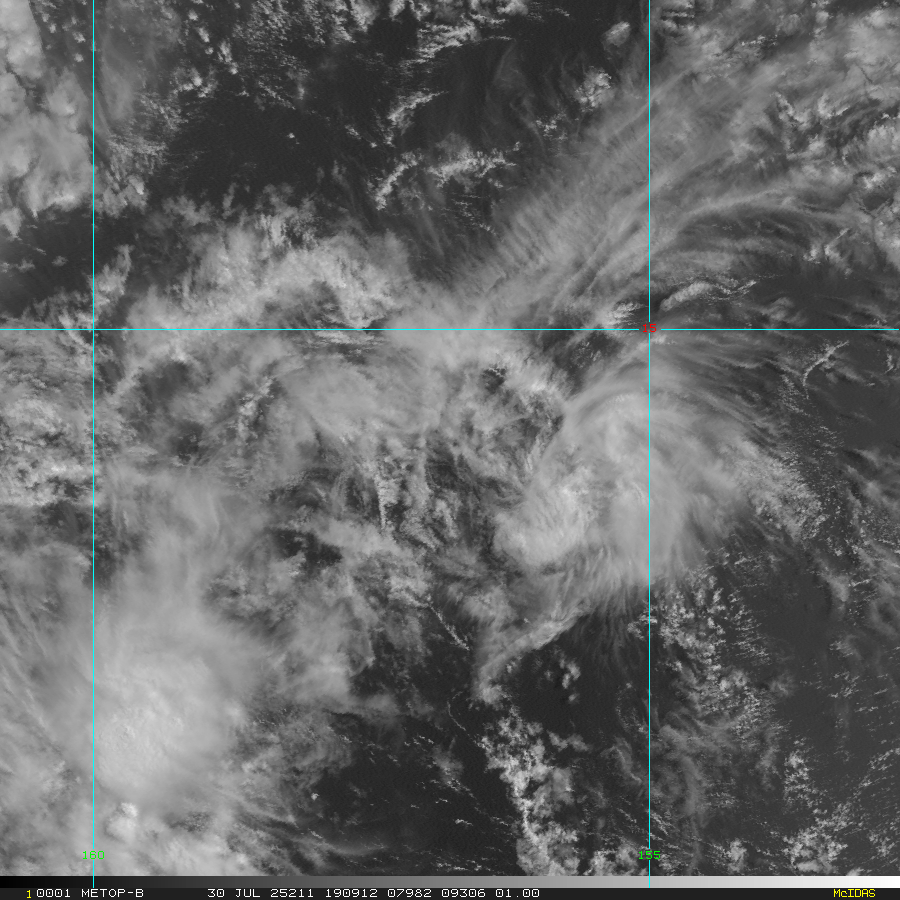
Visible Imagery (1 km Mercator, MODIS/AVHRR)

Loop | Latest Image | Archive | About
Time of This Image: 2025-07-30 19:09
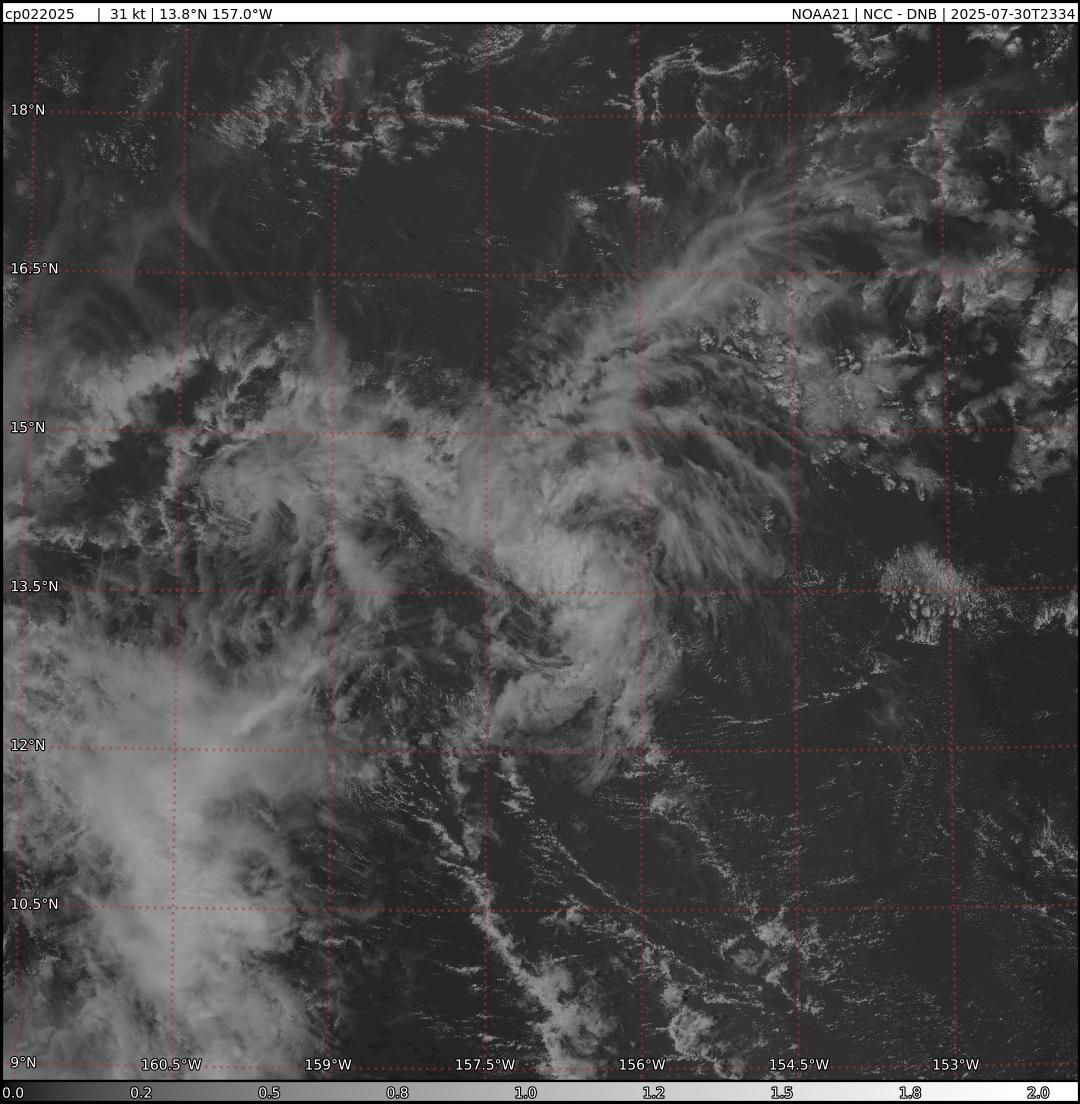
VIIRS Day/Night Band Near-Constant Contrast

Loop | Latest Image | Archive | About
Time of This Image: 2025-07-30 23:34
Satellite Products

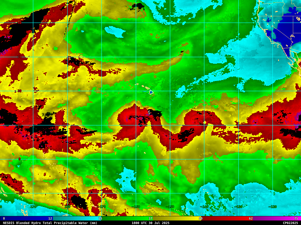
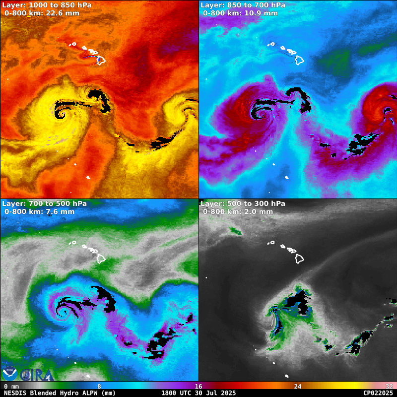
Advected Layer Precipitable Water

Loop | Latest Image | Archive | About
Time of This Image: 2025-07-30 18:00
GPROF Surface Precipitation Rate

Loop | Latest Image | Archive | About
Time of This Image: 2025-07-30 19:32
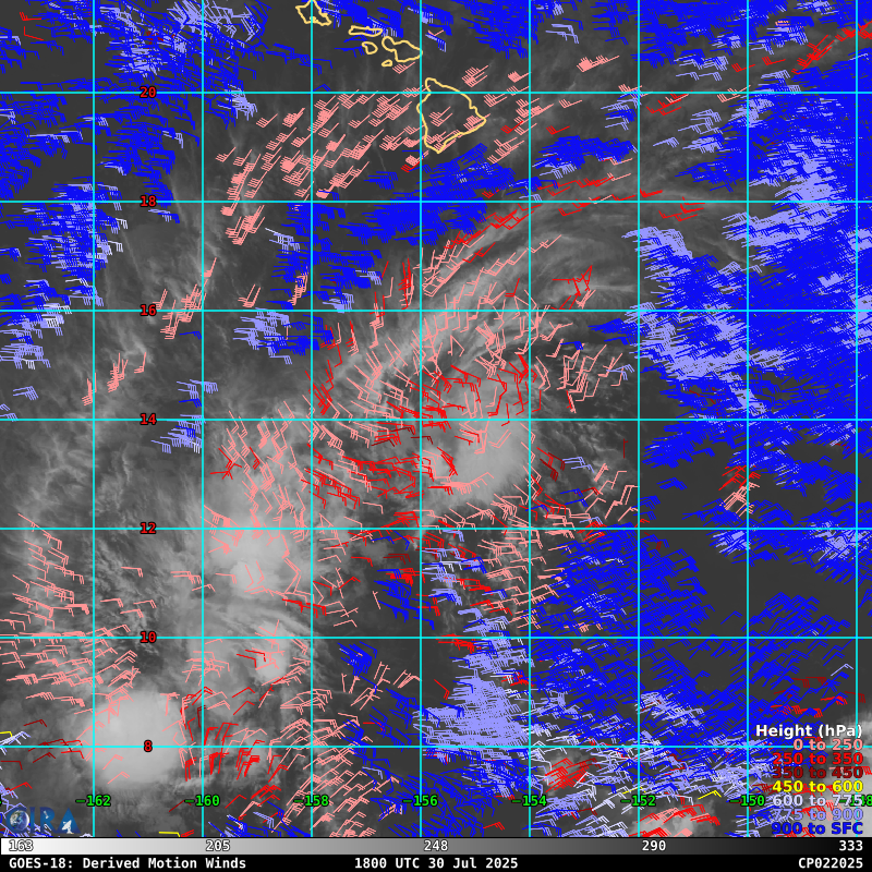
Geostationary Derived Motion Winds

Loop | Latest Image | Archive | About
Time of This Image: 2025-07-30 18:00
Geostationary Lightning Mapper

Loop | Latest Image | Archive | About
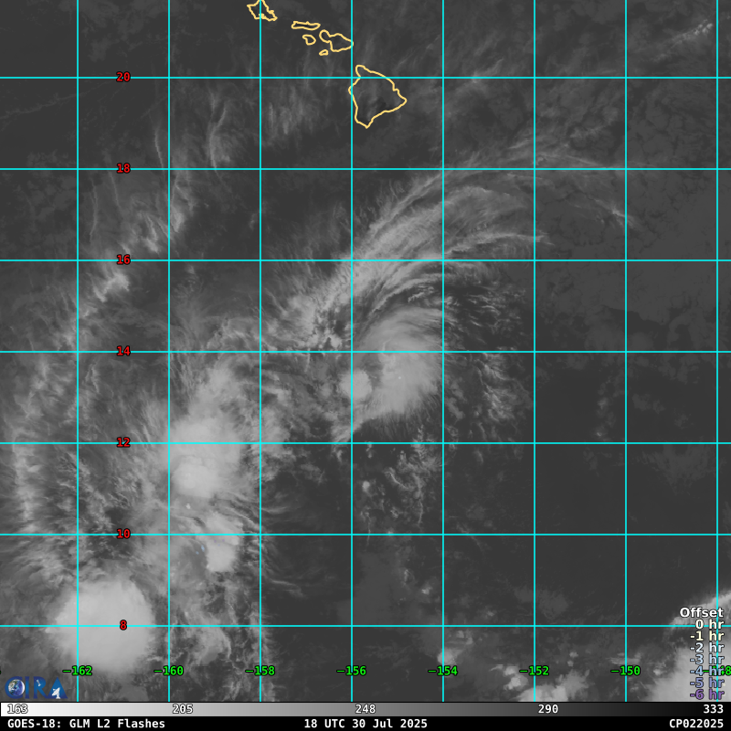
Time of This Image: 2025-07-30 18:00