Geostationary Imagery
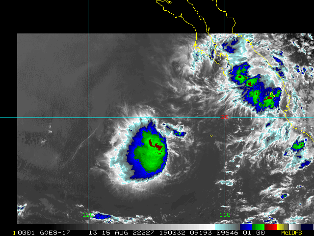
Enhanced Infrared (IR) Imagery (4 km Mercator)

Loop | Latest Image | Archive | About
Time of This Image: 2022-08-15 19:00
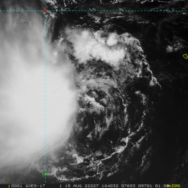
Storm Relative 1 km Geostationary Visible Imagery

Loop | Latest Image | Archive | About
Time of This Image: 2022-08-15 18:40
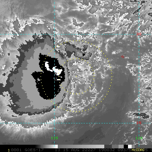
2 km Storm Relative IR Imagery with BD Enhancement Curve

Loop | Latest Image | Archive | About
Time of This Image: 2022-08-15 19:00
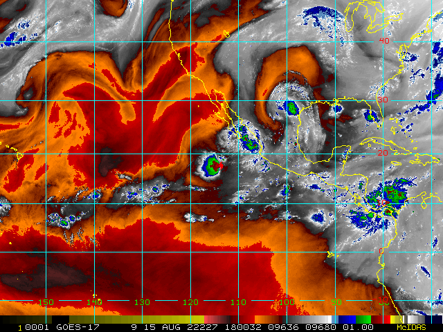
Storm Relative 16 km Geostationary Water Vapor Imagery

Loop | Latest Image | Archive | About
Time of This Image: 2022-08-15 18:00
Low-Earth Imagery
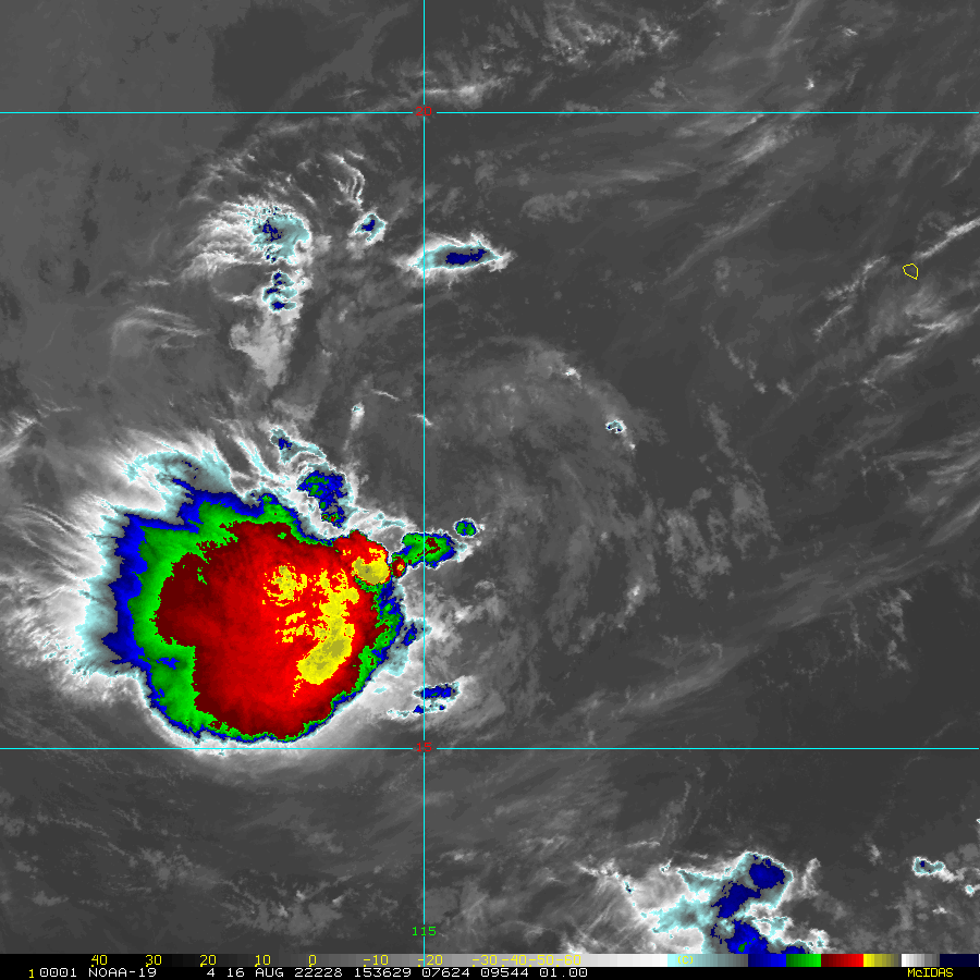
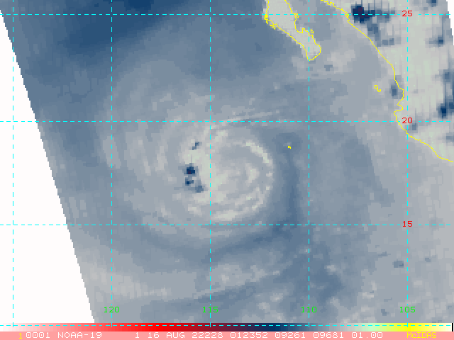
Enhanced Infrared (IR) Imagery (1 km Mercator, MODIS/AVHRR)

Loop | Latest Image | Archive | About
Time of This Image: 2022-08-16 15:36
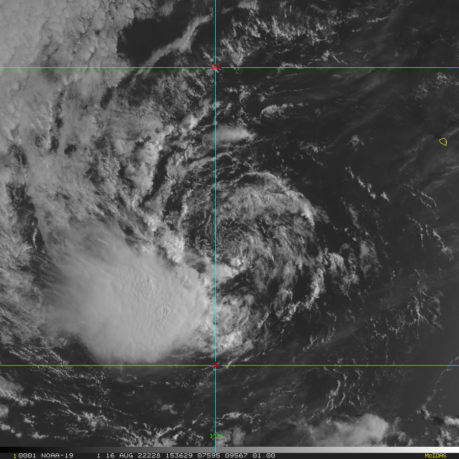
Visible Imagery (1 km Mercator, MODIS/AVHRR)

Loop | Latest Image | Archive | About
Time of This Image: 2022-08-16 15:36
Satellite Products
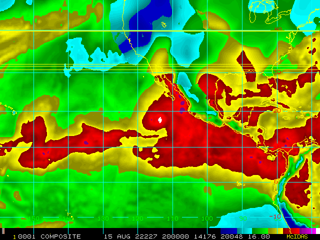
Storm Relative 16 km Microwave-Based Total Precipitable Water Imagery

Loop | Latest Image | Archive | About
Time of This Image: 2022-08-15 20:00
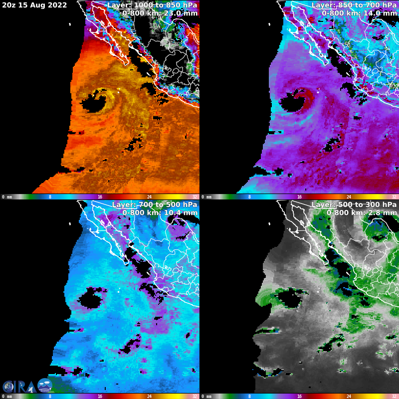
Advected Layer Precipitable Water

Loop | Latest Image | Archive | About
Time of This Image: 2022-08-15 20:00
Geostationary Derived Motion Winds

Loop | Latest Image | Archive | About
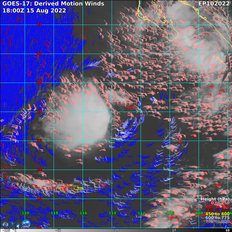
Time of This Image: 2022-08-15 18:00
Geostationary Lightning Mapper

Loop | Latest Image | Archive | About
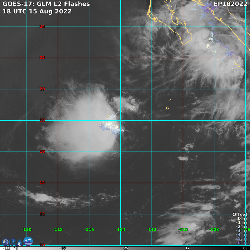
Time of This Image: 2022-08-15 18:00
AMSU Microwave 89 GHz Imagery (4 km Mercator)

Loop | Latest Image | Archive | About
Time of This Image: 2022-08-16 01:23