Geostationary Imagery
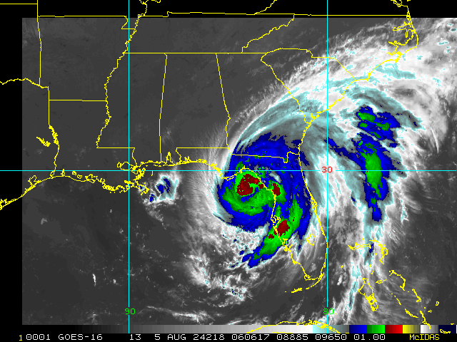
Enhanced Infrared (IR) Imagery (4 km Mercator)

Loop | Latest Image | Archive | About
Time of This Image: 2024-08-05 06:06
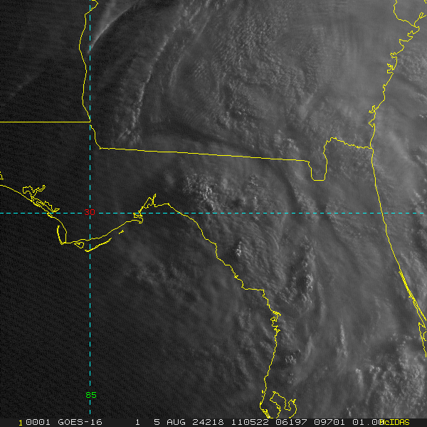
Storm Relative 1 km Geostationary Visible Imagery

Loop | Latest Image | Archive | About
Time of This Image: 2024-08-05 11:05
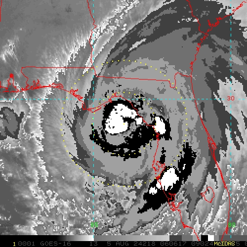
2 km Storm Relative IR Imagery with BD Enhancement Curve

Loop | Latest Image | Archive | About
Time of This Image: 2024-08-05 06:06
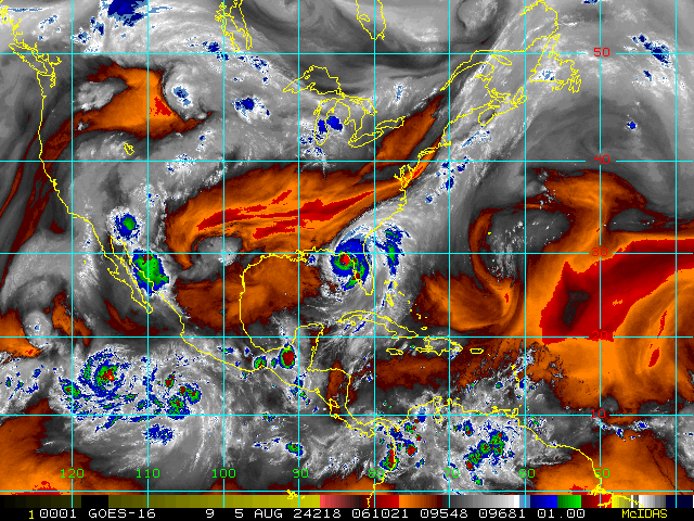
Storm Relative 16 km Geostationary Water Vapor Imagery

Loop | Latest Image | Archive | About
Time of This Image: 2024-08-05 06:10
Low-Earth Imagery
85 – 92 GHz Brightness Temperature

Loop | Latest Image | Archive | About
Time of This Image: 2024-08-05 07:45
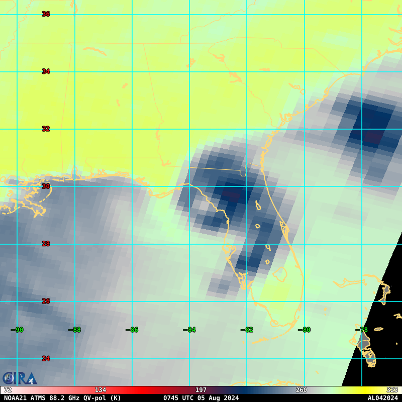
85 – 92 GHz Polarization-Corrected Brightness Temperature

Loop | Latest Image | Archive | About
Time of This Image: 2024-08-05 07:52
37 GHz Passive Microwave Imagery

Loop | Latest Image | Archive | About
Time of This Image: 2024-08-05 07:52
37 GHz Polarization-Corrected Brightness Temperature

Loop | Latest Image | Archive | About
Time of This Image: 2024-08-05 07:52
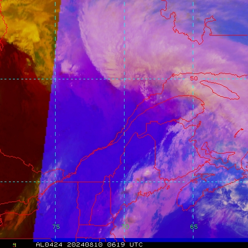
IR/WV/Microwave RGB (IR [R], WV [G], MI89 [B])

Loop | Latest Image | Archive | About
Time of This Image: 2024-08-10 06:19
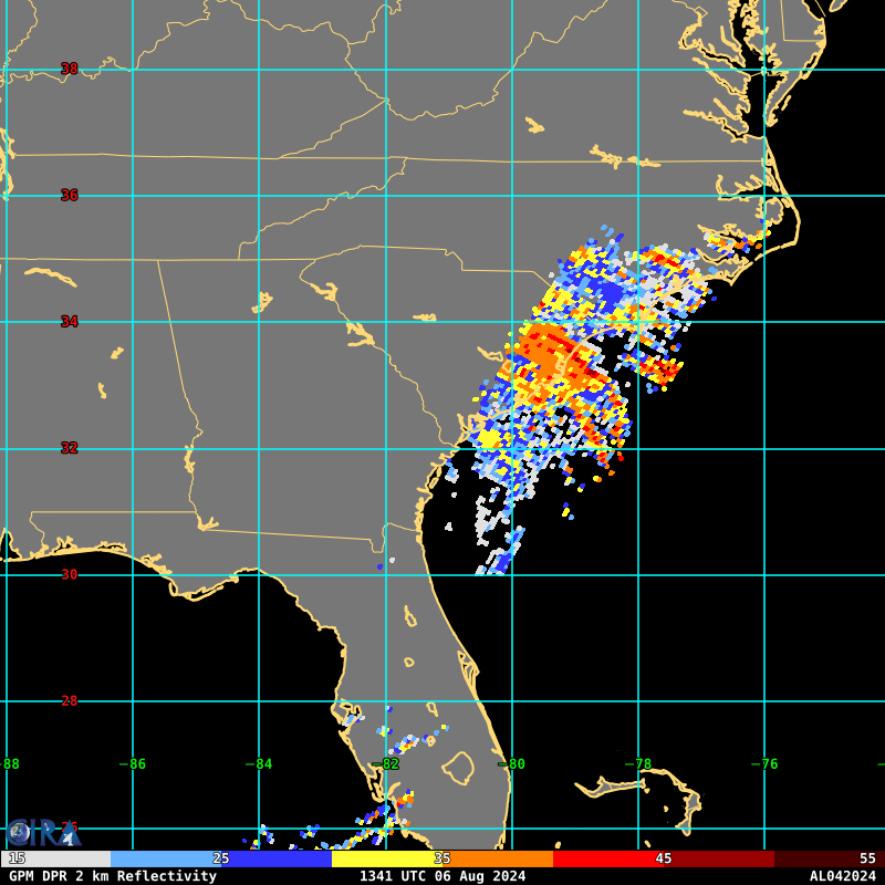
GPM DPR 2 km Radar Reflectivity

Loop | Latest Image | Archive | About
Time of This Image: 2024-08-06 13:41
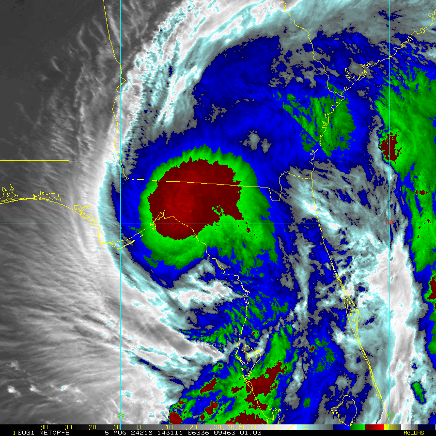
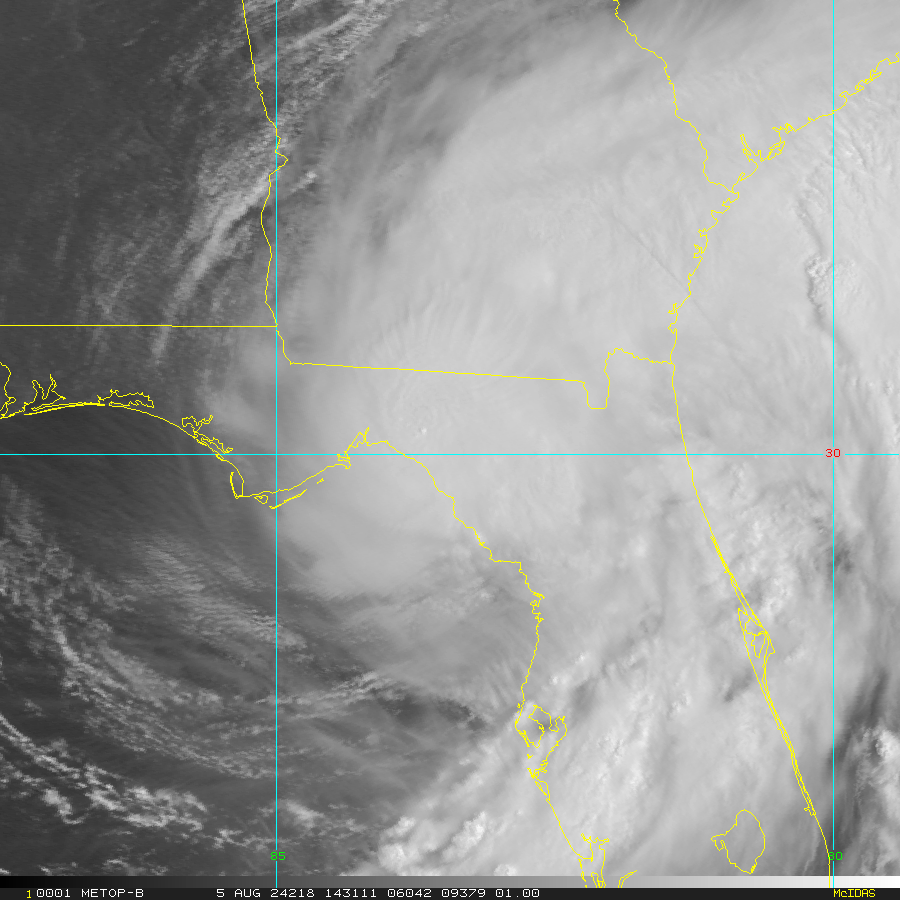
Enhanced Infrared (IR) Imagery (1 km Mercator, MODIS/AVHRR)

Loop | Latest Image | Archive | About
Time of This Image: 2024-08-05 14:31
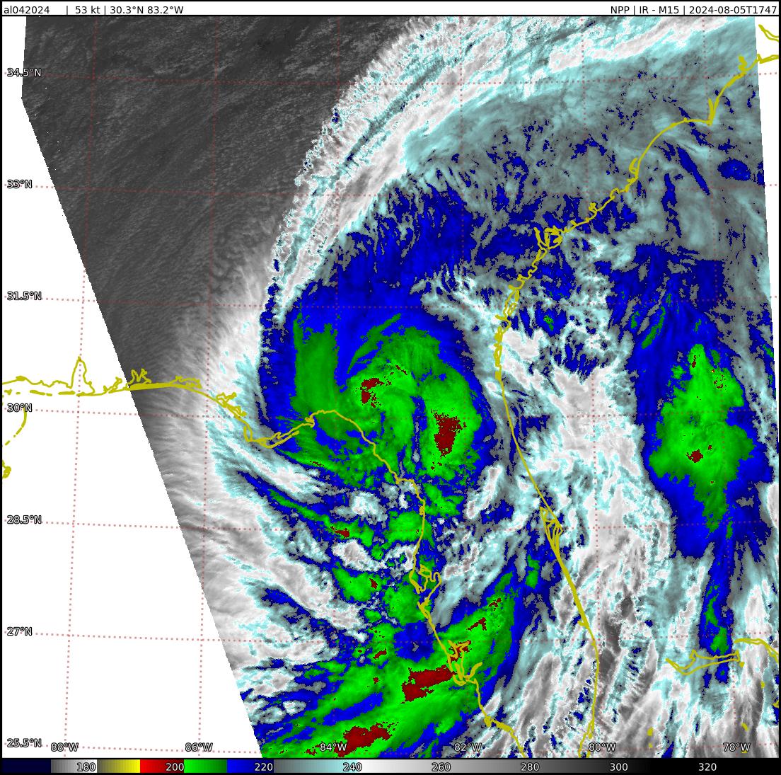
VIIRS EDR Infrared (IR) 750m 10.763μm

Loop | Latest Image | Archive | About
Time of This Image: 2024-08-05 17:47
Visible Imagery (1 km Mercator, MODIS/AVHRR)

Loop | Latest Image | Archive | About
Time of This Image: 2024-08-05 14:31
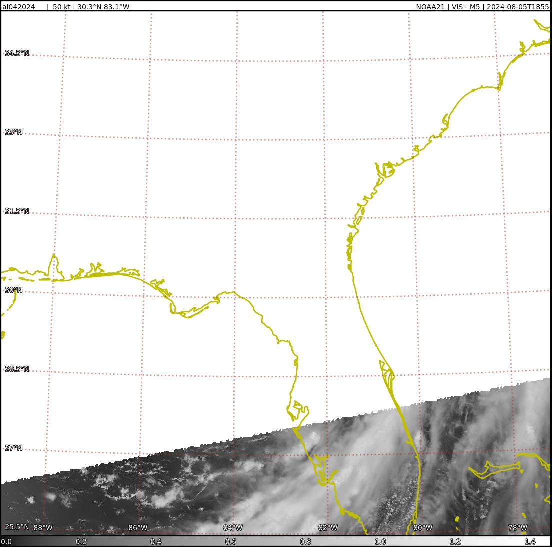
VIIRS EDR Visible 750m 0.672μm

Loop | Latest Image | Archive | About
Time of This Image: 2024-08-05 18:55
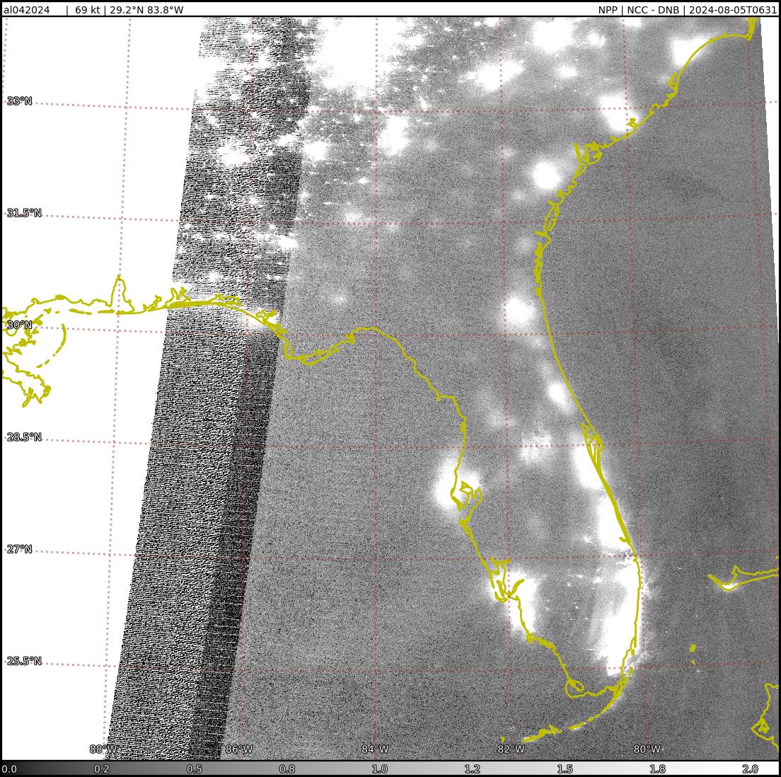
VIIRS Day/Night Band Near-Constant Contrast

Loop | Latest Image | Archive | About
Time of This Image: 2024-08-05 06:31
Satellite Products
Storm Relative 16 km Microwave-Based Total Precipitable Water Imagery

Loop | Latest Image | Archive | About
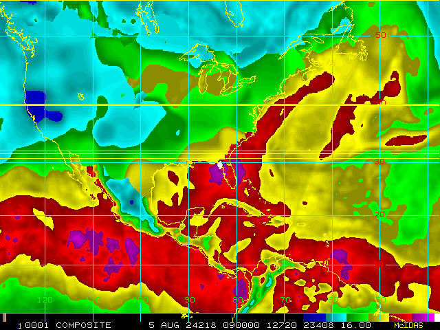
Time of This Image: 2024-08-05 09:00
Advected Layer Precipitable Water

Loop | Latest Image | Archive | About
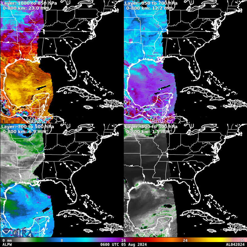
Time of This Image: 2024-08-05 06:00
GPROF Surface Precipitation Rate

Loop | Latest Image | Archive | About
Time of This Image: 2024-08-05 07:45
Geostationary Derived Motion Winds

Loop | Latest Image | Archive | About
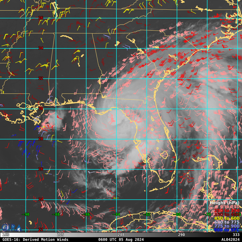
Time of This Image: 2024-08-05 06:00
Geostationary Lightning Mapper

Loop | Latest Image | Archive | About
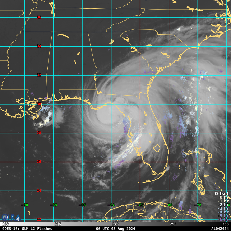
Time of This Image: 2024-08-05 06:00